|
Entertainment Magazine: Arizona: Sonoita-Elgin
Sonoita-Elgin
Entertainment Magazine
Prime Vineyards and Wineries in SE Arizona
Southeastern Arizona is well known for its
highly prized collection of vineyards and wineries spread throughout the
Sonoita-Elgin valley.
Sonoita, Arizona is a located about an hours drive south of Tucson, AZ., at the intersection of US Highway 82 and 83.
About 2,300 people live in and around the
area, according to the Sonoita-Elgin Chamber of Commerce. Most homes are
large ranch houses on five or more acres each. The Sonoita-Elgin area is well known for its vineyards.
There are eight major vineyards and wineries in the Sonoita/Elgin area in SE Arizona. Three times a year, Sonoita Vineyards Winery Festivals are among the most popular annual events.
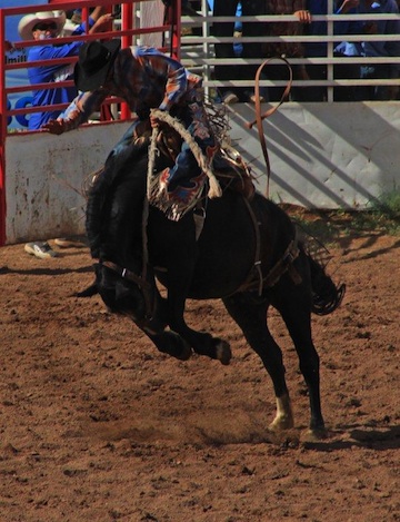
Photo right: Sonoita Rodeo photo by Carl Sparfeld
Sonoita-Elgin Index
Sonoita, AZ. Links
The Sonoita, Arizona area has rolling
grasslands at a 5,000 foot elevation, surrounded by the Huachuca,
Whetstone, Santa Rita and Mustang Mountains.The
Sonoita Appellation is 60 miles southeast of Tucson and west of Sierra
Vista, AZ. From Tucson, take I-10 east and turn right on HWY 83.
Since the Sonoita-Elgin, AZ. area has a lot of open land, there are vast opportunities for real estate development. Sonoita: former military post during the Civil War
The present-day vine filled valley of the
Sonoita area was developed long after Fort Buchanan (1856-61) became the
first military post within the bounds of the Gadsden Purchase in 1853.
The site, located over a mile west of Sonoita, protected settlers and
attacks from Chiricahua Apache Indians.
In November 1856, Maj. Enoch Steen completed
the formal establishment of what was known as Camp Moore. Lt. I. N.
Moore was in charge of a company of infantry. The name was changed on
November 17, 1856 to Fort Buchanan to honor James Buchanan, then
President of the United States. (Source: Arizona Place Names, by Will C.
Barnes, 1960).
"A detachment from the post, led by Lt.
George N. Bascom, was involved in the episode with Cochise at Apache
Pass that precipitated the Apache wars (1861-86). At the beginning of
the Civil War, Regulars evacuated and destroyed it. The following year,
General Carleton's California Volunteers occasionally camped at the
site. To aid in the renewed effort against the Apaches, the post was
reactivated as Camp Crittenden (1868-73) on a hill about one-half mile
to the east" (Source: Survey of Historic Sites and Buildings, National
Park Service).
Camp Crittenden was established on a hill
above the site of the abandoned Fort Buchanan. There is often confusion
between the two locations.
"In his annual report, Gen. Irvin McDowell
on September 14, 1867, reported that "General Crittenden has recommended
the building of a permanent camp near the site of old Fort Buchanan,
where there are many adobes, made before the war and which can be used
in new buildings. When built, the post at Tubac will be discontinued."
McDowell was referring to Gen. Thomas Leonidas Crittenden, 32nd
Infantry, who had served as a general of volunteers during the Civil
War. The new camp, named for Crittenden, was established on March 4,
1867. On June 8, 1872, it was announced that Camp Crittenden was to be
abandoned because of unhealthy conditions. Three weeks later a newspaper
article stated that the camp was in the process of breaking up." (ibid,
page 316).
The patent land where the sites of Fort
Buchanan and Camp Crittendenis were located are now privately owned.
They now contain homesites and are used for grazing. The only remains are
scattered rocks. mounds of earth, and fragmented adobe ruins (ibid).
Fort Crittenden reference from Weekly Arizona Miner, June 8, 1872, 2: 1, June 29, 1879, 2: 1; 75, p. 130. Maps: C-3; E-20; GL-3.
Photo: The hills surrounding the
Southeast Arizona communities of Sonoita, Elgin and Patagonia. This
photo is from Hog Canyon, west of Sonoita and site for the former Camp
Crittenden before it was moved east to Fort Buchanan. © 2011 BZB.
© 2013-2024 Sonoita Elgin Entertainment Magazine. EMOL.org. All rights reserved
|