|
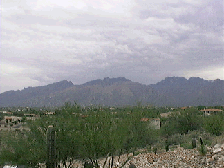
Entertainment Magazine: Tucson: Santa Catalina Mountains Related Events to history in the Santa Cruz ValleyThis is an excerpt from the book "Treasures of the Santa Catalina Mountains" by Robert E. Zucker. Download a free PDF sample of the book and purchase on Amazon.com.
1775, Hugo O’Conor declared Tucson as the new presidio site, probably, in October when the Tubac troops started construction. Col. Anza sent first correspondence from Tucson in 1776. (Tucson Presidio Trust). 1776, July 29, visitador comisario of New Mexico, Franciscan Atanasio Dominguez, and ministro doctrinero of Zuñi, Silvestre Velez de Escalante, leave from Santa Fé to discover a direct route to Monterey, on the seaboard of Alta California (History of Utah, 1540-1886, Chapter 1, Hubert H. Bancroft). There is no indication that Silvestre Escalante stayed long when he passed through San Xavier on his way northward during his expedition. Pasqual Escalante was a soldier at the Presidio in 1778. (“Pioneer Families San Agustin”) 1783, Franciscan missionary Fr. Juan Bautista Velderrain was able to begin construction on the present structure of San Xavier mission. Completed in 1797. 1787-1857: Royal Fort of San Rafael at Tubac. 1796, A group of 134 Papagos moved from Aquituni to Piman Tucson where 63 of them settled on 19 January 1796. (“Spanish Colonial Tucson, Franciscans at Work,”) 1796, “San Juan’s Day in June, Apaches raided the (Cañada del Oro) mine camp, killing and scattering the Papagos. The settlement was destroyed and forgotten. A clue to the Escalante is a ventaña – a natural hole in the rock resembling a window. The mine is “one league northwest of the ventaña,” according to John D. Mitchell.” (July 1952, DESERT). Colonel Antonio Narbona, on a military expedition against the Apaches, camped there and found placer nuggets. By May 1870, miners were “panning between $12 and $30 a day.” Apache attacks kept miners away for about 10 years. Donald Page reports first known discovery of gold in the Cañada del Oro was on June 29, 1843. (“The Lost Escalante” chapter in the “Lost Gold and Silver Mines of the Southwest,” Eugene L. Conrotto, 116). Note: 1 league is about 3.4 miles. At that distance from “Window Rock” (La Ventaña) is the edge of Montrose Canyon where ruins are located, as described by Donald Page (below). 1821, Spanish Franciscans leave. Fort at San Agustin del Tucson closes when Mexico gains indpeendence from Spain in the Mexican revolution. 1828 mid-April, “an Apache war party attacked and massacred seven settlers at the placers just to the west "in the sierrita" between the rancho of Arivaca and the presidio of Tubac.” 1828, Mexican government order to abandon missions. 1829 November-December, Jefe Político Manuel Escalante y Arvizu, jefe politico of the department of Arizpe (1831 became first governor of new state of Sonora with its capital city in Arizpe, visited the four north missions in the Pimeria (San Xavier, Santa Cruz, Tubac and Tucson) because of certain inequities, including accounting and Indians complaints of mistreatment.” “January 22, 1830, the mission properties reverted to the Franciscan friars' care. That spring Grande and Pérez Llera made the rounds together effecting the transfer of what was left at each mission.” (“Friars, Soldiers and Reformers,” chapt 11). Note: November 2, 1833 a cholera epidemic hits Sonora. 1831, “When don Leonardo Escalante, of Bacoachi, the provisional governor of separated Sonora, reported in August, 1831, to the minister of justice and ecclesiastical affairs in Mexico City, he explained that the documents setting forth the state of the missions during their civil administration had been carried off to Durango.” He also claimed that Tumacacori owed him 300 head of cattle. 1832, May 1, “don Manuel Escalante y Arvizu, ex-jefe político of Arizpe, took office as the first constitutionally elected governor and proceeded to the feat of serving a full four-year term.“ (“Friars, Soldiers and Reformers,” chapt 11) 1842 Pbro. Juan Francisco Escalante, parish priest at Hermosillo, visits Tubac and towns and mission in northern Pima county (“Tubac Through the Centuries”). 1847, by treaty of Guadalupe Hidalgo, all of the territory north of the Gila River now included in Arizona was ceded to the United States. 1849, February 29 “The people of the presidio of Tubac and of the pueblo of Tumacácori have removed to the presidio of Tucson as a consequence of the murders committed by the barbarians during the month of December last. From El Sonorense” (“Friars, Soldiers and Reformers,” chapt 11). 1855-56, American troops take possession of Tucson and Tubac. The Mexican army takes the civil, church and military records, possibly to Imuris. Reports of Ruins in the Santa Catalinas1858, Dr. Robert Forbes (his notes of June 20, 1915, p 39) writes that Sam Hughes first saw ruins in 1858, located on west side of the Santa Catalinas at present-day Catalina State Park. George Hand writes in his diary that he rode out to see the ruins. Called Mission of Ciru by Archbishop Salpointe, according to Agustin Tomé. (Source: Data Relatives to Spanish and Indian Ruins on Mesa Between Montrose and Romero Canyon known as the Rancho Viejo or the “Mission of Ciru” Donald Page papers, c 1927, AHS). 1880, March 4, “Iron Door Mine” first published newspaper article reporting ruins found in middle of Santa Catalinas near “Mine with the Iron Door” by two prospectors at a place called Nueva Mia Ciudad (“Nine Mile City”) that once had a legendary “monster church with a number of golden bells.” They found the remains of a stone building of granite and marble after the style of the old Cocospari church in Sonora. They found bars of iron lying down at the mouth of a nearby tunnel. This is the earliest published account of a local legend that began over 100 years prior when the Jesuits controlled the land. When the Jesuits left, they placed an iron door to seal the mine and destroyed the two entrances to the location. The writer notes this tradition of the Santa Catarinas is known by many old Arizonans. The two prospectors met an old Mexican in Caborca whose grandfather had kept a diary of life in the Nine Mile City and its location. (“AZ Weekly Star”). Note: 9 miles is 2.6 miles, but 9 leagues are about 31 miles – present day Saddlebrooke near the Canada del Oro ruins. The term Nine Mile City could have been confused with Nine League City, as league was the Spanish measurement used for diatnace- liga. Nuevo Liga Ciudad would be correct. 1882, December 31, “At their meeting on the 28th the Board of Supervisors established polling precinct No. 21 at Pueblo Viejo, place of voting at Romero's ranch; Inspector, John Zellweger; Judges of Election, Francisco Romero and Miguel Martinez.” (Arizona Weekly) 1883, Nov 27, “Stone Church” newspaper article relating stories heard of ruins by Judge Charles Meyer called “Pueblo Viejo” that had a “stone church” made of granite with a mosaic floor and arched roof between “the Finger Mountain and Ventana Canyon.” Placer diggings were found nearby. May have been abandoned at the turn of the century and inhabited by Apaches until they died of smallpox in 1861. The Judge has seen the gold and silver. Meyer also relates story of the Indians who moved from villages along the San Pedro and chased by Apaches through the west side of the Santa Catalinas (into the Canyon del Oro), then chased again to the area of the stone church ruins until they were killed by the Apaches who settled there at the beginning of the century (1880s- see the story of the San Juan Day massacre in 1796) (“AZ Weekly Citizen”). 1884, January 19, “At the Ventana divide there is a never failing stream that flows down to the Canyon de Oro. This latter canyon opens in the Santa Catalinas above Pueblo Viejo, and trends around to the east and south, heading towards the divide at the north base of Mt Lemmon. This canyon also has three large forks,” reports Ira Carter in a newspaper article (“Arizona Weekly Citizen”). 1886, May 1, a newspaper articles reports that “Tombstone has the threadbare story of the mine with the iron door, located in the Cananea mountains. When tradition fastened the iron door to the mine of fabulous riches, iron doors were more scare than rich mines.” (“Arizona Weekly Citizen”) 1887, May 14, “Two large gold mines have been opened by the earthquakes in the Santa Catalina mountains. Some of these days an enterprising earthquake in Arizona will open a dry goods store or a barber shop. Philadelphia News.“ (“Arizona Weekly Star”). 1927 September, typed report by Donald Page about ruins near present-day Catalina State Park on the west side of the Santa Catalinas, near the Romero ranch ruins (on a mesa between Montrose Canyon and Romero Canyon). The ruins represent 4 periods of culture: round stone pit houses; rectangular pit houses; single and multi room houses; and multi-room adobe walled communal building. The stones were laid in mud mortar, and may be an early Spanish type of stone walled building. Signs of Mexican construction with paved foundations and floors. Also called Ciudad Nuevo Millas.” Located “9 miles from Tucson” (“Data Relative to Spanish and Indian Ruins.” Donald Page papers, AHS). Note: the site is actually 18 ½ m from Tucson and 31 miles or 9 leagues from San Xavier- see note below. 1956 Donald Page writes in a magazine article that the mine was “located close to an early Spanish mining camp that lies on a mesa in a nearly inaccessible part of the mountains.” The Jesuits owned the mine and camp and later built a church. The mine was worked until their expulsion in 1767. A “group of mysterious ruins lie on a small mesa east of the lower end of the canyon (Cañada del Oro) may be a link to the lost mine.” (Oct 1956, DESERT, “Lost Jesuit Mine with the Iron Door”). Description of “traces of an old walled, stone-built city could be the ruins of a Hohokam village from 500-1450AD. The 15 acre site is managed by Catalina State Park. Earlier mention of this site on record was in 1875, thirteen years after the California Volunteers published their observations in the Alta. Francisco Romero had a ranch on the west side of the Catalinas in 1844.” (“The Civil War in Arizona: California Volunteers 1861-1865,” Andrew Maisch, 204). Note: distance was measured in leagues (liga, legua) during Spanish times. One league is about 3.4 miles. The Lost Santa Catalina MissionTreasures of the Santa Catalina MountainsTucson Entertainment Magazine© 2012-2018 EMOL.org / Tucson Entertainment Magazine On Line. All rights reserved |