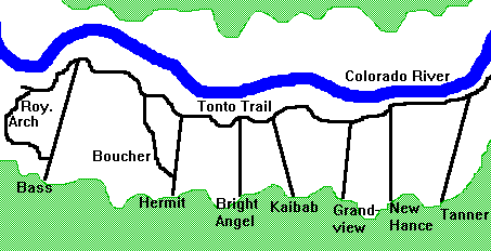
Arizona: Grand CanyonNew 2nd Edition printed April,
2007. Improved shaded relief gives a beautiful, detailed & stunning
view of the canyon. Mileage info added to all trail junctions, plus
cummulative mileage for select segments. Trail profile graphs added.
Thoroughly reviewed by Park rangers. Detailed topographic & trail
map of 308,000 acres in central Grand Canyon. 1:40,000 scale covers 8
USGS quads. 295 miles of trails shown with trail ratings, descriptions
& statistics. Most complete & accurate map of the area. Includes
contours, shaded relief, UTM grid, hydrography with springs &
drinking water, backcountry use zones for permit planning, and other
trip information. Printed on waterproof, tear-tough paper. This map
covers the huge core of Grand Canyon National Park. This is the area
where 99% of visitors travel and where 90% of backcountry trips take
place, and where most trails and reliable water sources are. Hope you
like the new edition! Publisher: Sky Terrain (September 1, 2001)
|
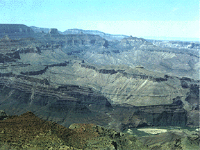
Grand Canyon, ArizonaGrand Canyon Tour
|
Arizona
|